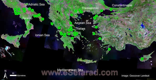
The aim of the project is to map the Jewish presence in the Byzantine empire using GIS (Geographical Information Systems).
All information (published and unpublished) about the Jewish communities will be gathered and collated.
The data will be incorporated in a GIS which will be made freely available to the general public on the world-wide-web.
Researchers and members of the public will be able to create maps according to their own specifications.
Chronologically, the project will begin in 650. This is soon after the Arab conquest of Egypt, Palestine and Syria when these regions, with their substantial Jewish populations, were permanently separated from the Byzantine empire. The end-date is fixed by the arrival in the region of large numbers of Jewish immigrants from Spain in 1492.
Geographically, the core areas of Asia Minor, the southern Balkans and the adjacent islands including Crete and Cyprus will be included for the entirety of the period, Byzantine Italy however, will only be covered down to the Norman conquest. Some smaller territories that were only briefly under Byzantine rule may be excluded.
NEWSFLASH! The project’s Web-GIS is now live and accessible at http://www.byzantinejewry.net